Geography 101: Northern Africa

What We Did Today:

Hello! 👋

Don’t touch my chickie!

EQ: What countries are located in Northern Africa?

Essential Skills:

HS.G 1.1 : Use geographic data to explain and analyze relationships between locations of place and regions.

HS.G 1.2: Use geospatial tools and related technologies to construct relevant geographic data to explain spatial patterns and relationships.

DOK1: Define and explain how to read and interpret a map. (e.g physcial, political, topographical).

DOK2: Demonstrate an apporpriate use of an atlas.

I can locate, label, and color the countries of Northern Africa.

Agenda: Northern Africa Map Study

Just for Fun: Can You Name a Country?

This will not be you after this unit! Except for the kid that rocked it at the end – that will be you!

A blank map of Africa will be provided in class. If you are absent or lost it, you may print a copy using the file posted on Google Classroom.

Label and color the following countries using the in-class atlas or online sources. Do not go beyond this list. If I see you labeling countries that are not on the list, I will take your map and you’ll have to start all over again.  I mean it!

Resource Link: World Map

Earning Passport Stamps

Once you think you’ve correctly labeled and colored your map, come and see me for a passport stamp. I’ll be reviewing your map with the following guidelines in mind:

If your map does not meet these criteria I will send you back to fix it!

A passport stamps means you’ve got full credit on your map. Collect all 8 to complete your trip around the world. 🙂


What To Do Tonight: 

Finish the Northern part of Africa. 🙂

If you’re not practicing you should be!  Here are some links to help you practice with the continents we’ve fully completed up to this point:

European Countries Game

North America Countries Game

South American Countries Game

We’ll practice Africa once the map is fully completed! 🙂

Geography 101: Geography Vocabulary (Day 1)

What We Did Today:

Hello! 👋

Are there definitions in here?

EQ: What are key vocabulary terms for geography?

Essential Skills:

HS.G 1.1 : Use geographic data to explain and analyze relationships between locations of place and regions.

HS.G 1.2: Use geospatial tools and related technologies to construct relevant geographic data to explain spatial patterns and relationships.

DOK1: Define and explain how to read and interpret a map. (e.g physcial, political, topographical).

DOK2: Demonstrate an apporpriate use of an atlas.

I can define key geography vocabulary terms.

Agenda: Geography Glossary

Time for a map break! To give our brains a chance to absorb all the information on the maps we’ve created, we are going to step away from those maps for a bit. Instead, we are going to focus on some vocabulary terms.

Today we are going to start the process of creating an illustrated glossary of geography vocabulary.

You will be working with 10 vocabulary words today, which are listed in the document below, along with directions on the options for completing your illustrated glossary.

Each vocabulary terms will require a definition and a visual that shows what the word means. Some words are in your notes, while others will require a little research. Big Hint: Make sure your definitions relate to geography!

Vocabulary List: Day 1

Ideas:

  • Flip Book
  • Slide presentation
  • Chart
  • booklet
  • poster
  • flashcard set (not quizlet!)
  • collage

What To Do Tonight:

Finish today’s vocabulary list!

Practice!

European Countries Game

More practice:

North America Countries Game

South American Countries Game

Geography 101: Eastern Europe

What We Did Today:

I know, it’s a Monday!

EQ: What countries are located in Eastern Europe?

Essential Skills:

HS.G 1.1 : Use geographic data to explain and analyze relationships between locations of place and regions.

HS.G 1.2: Use geospatial tools and related technologies to construct relevant geographic data to explain spatial patterns and relationships.

DOK1: Define and explain how to read and interpret a map. (e.g physcial, political, topographical).

DOK2: Demonstrate an apporpriate use of an atlas.

I can locate, label, and color the countries of Western Europe.

Agenda: Eastern Europe Map Study

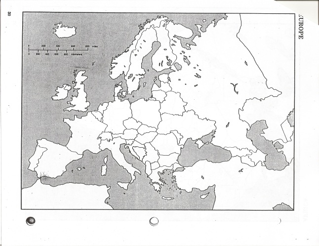
We will be adding to the map of Europe that we started yesterday. If you are absent or lost it, you may print a copy using the file posted on Google Classroom.

Geo 101 Pkt Europe

Label and color the following countries using the in-class atlas or online sources. Do not go beyond this list. If I see you labeling countries that are not on the list, I will take your packet and you’ll have to start all over again.  I mean it!

Resource Link: World Map

Earning Passport Stamps

Once you think you’ve correctly labeled and colored your map, come and see me for a passport stamp. I’ll be reviewing your map with the following guidelines in mind:

If your map does not meat these criteria I will send you back to fix it!

A passport stamps means you’ve got full credit on your map. Collect all 8 to complete your trip around the world. 🙂 Upload a photo of your stamped map to Google Classroom and hit the submit button.

Extra Credit: 27 Facts About Maps

Bullet 10 cool facts about maps on the back of your Europe map and you can earn some extra credit. 🙂


What To Do Tonight: 

Practice!

European Countries Game

More practice:

North America Countries Game

South American Countries Game

Geography 101: Western Europe

What We Did Today:

Hello! 👋

What did you say?

EQ: What countries are located in Western Europe?

Essential Skills:

HS.G 1.1 : Use geographic data to explain and analyze relationships between locations of place and regions.

HS.G 1.2: Use geospatial tools and related technologies to construct relevant geographic data to explain spatial patterns and relationships.

DOK1: Define and explain how to read and interpret a map. (e.g physcial, political, topographical).

DOK2: Demonstrate an apporpriate use of an atlas.

I can locate, label, and color the countries of Western Europe.

Agenda: Western Europe Map Study

A blank map of Europe will be provided in class today. If you are absent, you may print a copy using the file posted on Google Classroom.

Geo 101 Pkt Europe

Label and color the following countries using the in-class atlas or online sources. Do not go beyond this list. If I see you labeling countries that are not on the list, I will take your handout and you’ll have to start all over again. I mean it!

Resource Link: World Atlas

Earning Passport Stamps

Once you think you’ve correctly labeled and colored your map, come and see me for a passport stamp. I’ll be reviewing your map with the following guidelines in mind:

If your map does not meet these criteria I will send you back to fix it!

A passport stamps means you’ve got full credit on your map. Collect all 8 to complete your trip around the world. 🙂 Upload a photo of your stamped map to Google Classroom and hit the submit button.

Extra Credit: 27 Facts About Maps

Bullet 10 cool facts about maps on the back of your Europe map and you can earn some extra credit. 🙂


What To Do Tonight: 

Finish your Western European map! DO NOT go beyond the list or you’ll lose your map. 🙂

More practice:

North America Countries Game

South American Countries Game

We’ll practice Europe when the map is complete! 🙂

Geography 101: North & South America

Hello! 👋

Mine.

What We Did Today:

EQ: What countries are located in North & South America?

Essential Skills:

HS.G 1.1 : Use geographic data to explain and analyze relationships between locations of place and regions.

HS.G 1.2: Use geospatial tools and related technologies to construct relevant geographic data to explain spatial patterns and relationships.

DOK1: Define and explain how to read and interpret a map. (e.g physcial, political, topographical).

DOK2: Demonstrate an apporpriate use of an atlas.

I can locate, label, and color the countries of North and South America.

Agenda: North & South America Map Study

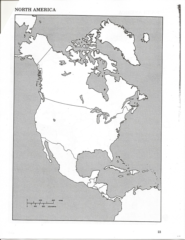
Blank maps of North and South America will be provided in class today. If you are absent, you may print a copy using the files posted on Google Classroom.

Geo 101 Pkt N Amer

Label and color the following countries using the in-class atlas or online sources:

Resource Link: World Atlas

Earning Passport Stamps

Once you think you’ve correctly labeled and colored your map, come as see me for a passport stamp. I’ll be reviewing your map with the following guidelines in mind:

If your map does not meet these criteria I will send you back to fix it!

A passport stamps means you’ve got full credit on your map. Collect all 8 stamps to complete your trip around the world. 🙂 Upload a photo of your stamped map to Google Classroom and hit the submit button.

A Little Map Trivia:


What To Do Tonight: \

Finish your maps for North and South America 🙂

Practice locating countries:

North & Central America Game

South American Countries

Geography 101: World Geography Challenge

What We Did Today

Hello! 👋

Let’s go!

EQ: How many countries can you correctly identify on a map?

Essential Skills:

HS.G 1.1 : Use geographic data to explain and analyze relationships between locations of place and regions.

HS.G 1.2: Use geospatial tools and related technologies to construct relevant geographic data to explain spatial patterns and relationships.

DOK1: Define and explain how to read and interpret a map. (e.g physcial, political, topographical).

DOK2: Demonstrate an apporpriate use of an atlas.

I can locate countries of the world on a map.

Agenda: World Geography Challenge

On a piece of paper, title the top line with “Geography Challenge.”

Click on this link: World Geography Games

  • We are going to play point and click games for each of the following Continents/Regions:
    • Africa
    • Asia
    • Europe
    • Middle East
    • North & Central America
    • Oceania & Southest Asia
    • South America
  • List each map region on your piece of paper. Skip two lines between each region to leave some room to jot things down.
  • The game will start by asking you to click on the location of a country. Work your way through the entire game.
  • Record your score in each region.

Self Assessment

How would you rate your geographic knowledge on a scale of 1-10 (1 being I’m always lost and 10 being I got this!).

What To Do Tonight:

Pack your colored pencils! 🙂

Geography 101: Mapping Your Community (cont’d)

What We Did Today

Hello! 🙂

^^^ If this raccoon can ride a bike, you can draw a map!

EQ: How do you apply geography skills to the world around you?

Essential Skills:

HS.G 1.2: Use geospatial tools and related technologies to construct relevant geographic data to explain spatial patterns and relationships.

Use images, tables, graphs to interpret geographic relationships between regions. (DOK 1)

Objectives: Create a community map that visualizes and applies geographic vocabulary defined throughout the unit

Agenda: Mapping Your Community

We chatted about our mapmaking progress and had a little Q&A session.

Assignment: Mapping Your Community

Continue the assignment we started yesterday!

Log in to Google Classroom. Complete the assignment below using one of the two options given in the document. If you need help attaching a photo of your work, please let me know so I can help! Be sure to hit the submit when you’re don!

Resource Map Layout:

What To Do Tonight 

Finish up your mapping assignment. 🙂

Geography 101: Mapping Your Community

What We Did Today

Hello! 🙂

^^^ So close, yet so far! 🙃

EQ: How do you apply geography skills to the world around you?

Essential Skills:

HS.G 1.2: Use geospatial tools and related technologies to construct relevant geographic data to explain spatial patterns and relationships.

Use images, tables, graphs to interpret geographic relationships between regions. (DOK 1)

I can create a community map that visualizes and applies geographic vocabulary defined throughout the unit.

Agenda: Catch Up & Mapping Your Community

Let’s finish up Friday’s assignment! We did a little Q&A on time zones and then jumped into the Road Map section of the asisgnment.

After that, we discussed today’s little project and got started on mapping out a chosen location in your community using the skills we’ve learned in this unit.

Assignment: Mapping Your Community

Log in to Google Classroom. Complete the assignment below using one of the two options given in the document. You will have two days to complete this assignment, today and tomorrow.

Resource Map Layout:

What To Do Tonight 

Finish up your mapping assignment. 🙂

Geography 101: Practical Geography

What We Did Today

Hello! 👋

^^^ 😂

EQ: What are some everyday uses of geography?

Essential Skills:

HS.G 1.1 : Use geographic data to explain and analyze relationships between locations of place and regions.

HS.G 1.2: Use geospatial tools and related technologies to construct relevant geographic data to explain spatial patterns and relationships.

DOK1: Define and explain how to read and interpret a map. (e.g physcial, political, topographical).

DOK2: Demonstrate an apporpriate use of an atlas.

I can apply geographic skills to everyday life, (i.e. time zones, road map)

Agenda:

We discussed that geography is might be something we  use on a daily basis without even realizing it! We talked about time zones and road maps and how they are an essential part of life.

First, we started with a little practice with time zones. Let’s see if we can navigate a typical day in Mrs. Davis’ life!

Assignment: Practical Geography Packet

Log in to Google Classroom. You’ll see a document that gives you a place to respond to the questions on the worksheets below. Each worksheet has a title and numbered space that align to the questions. Type in your responses and hit the submit button! You may also complete this assignment on paper and upload a photo of your work.

What To Do Tonight

Try to get through at least half of today’s assignment! 👍

Geography 101: Identifying Maps

What We Did Today

Hello! 🙂

^^^ Calm down, it’s just a kitten! 😂

EQ: What kinds of information are in an atlas or on a map?

Essential Skills:

HS.G 1.1 : Use geographic data to explain and analyze relationships between locations of place and regions.

HS.G 1.2: Use geospatial tools and related technologies to construct relevant geographic data to explain spatial patterns and relationships

DOK2: Demonstrate an apporpriate use of an atlas.

Objectives: Identify and interpret different types of maps.

Agenda: Vocabulary

We discussed some quick vocabulary on how different kinds of maps provide a variety of information.

Assignment: Identifying Maps

Log in to Google Classroom and complete the assignment below. You’ll see that attached document in the posted assignment in your stream. Complete the assignment and hit the submit button when you’re done. You may also complete this assignment on a piece of paper and upload a photo of your work.

What To Do Tonight

Finish up today’s assignment. 👍

Catch up on any missing assignments.