What We Did Today
Hello!

EQ: What can a map tell us about the Cold War?
Essential Skills: Locate and identify key locations on a map and apply historical context.
I can: Create a map that tells the story of the beginning of the Cold War.
Agenda: Constructing a Cold War Map
Today we are going to get crafty and create a map from scratch to help us visualize what the beginning of the Cold War looked like and how it played out geographically.
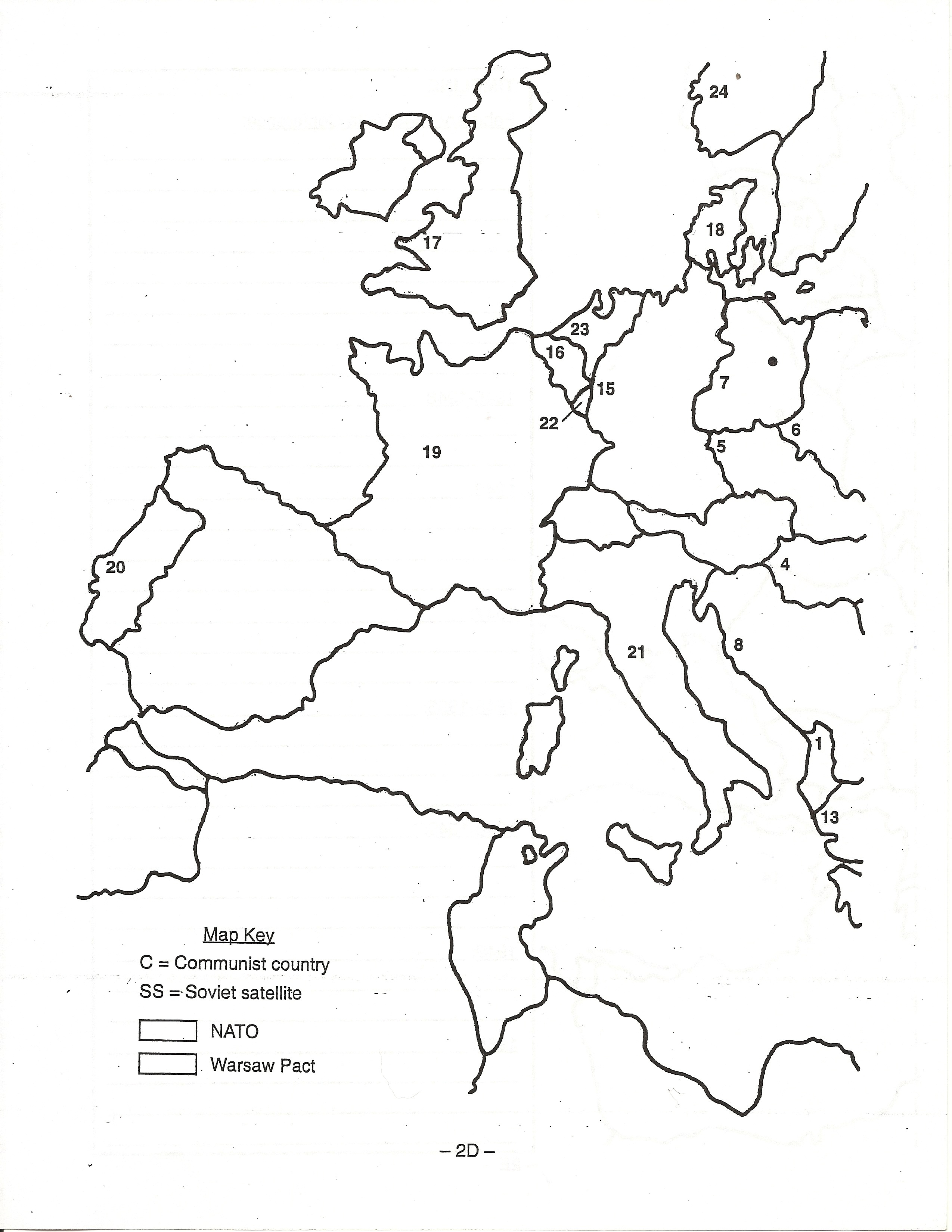
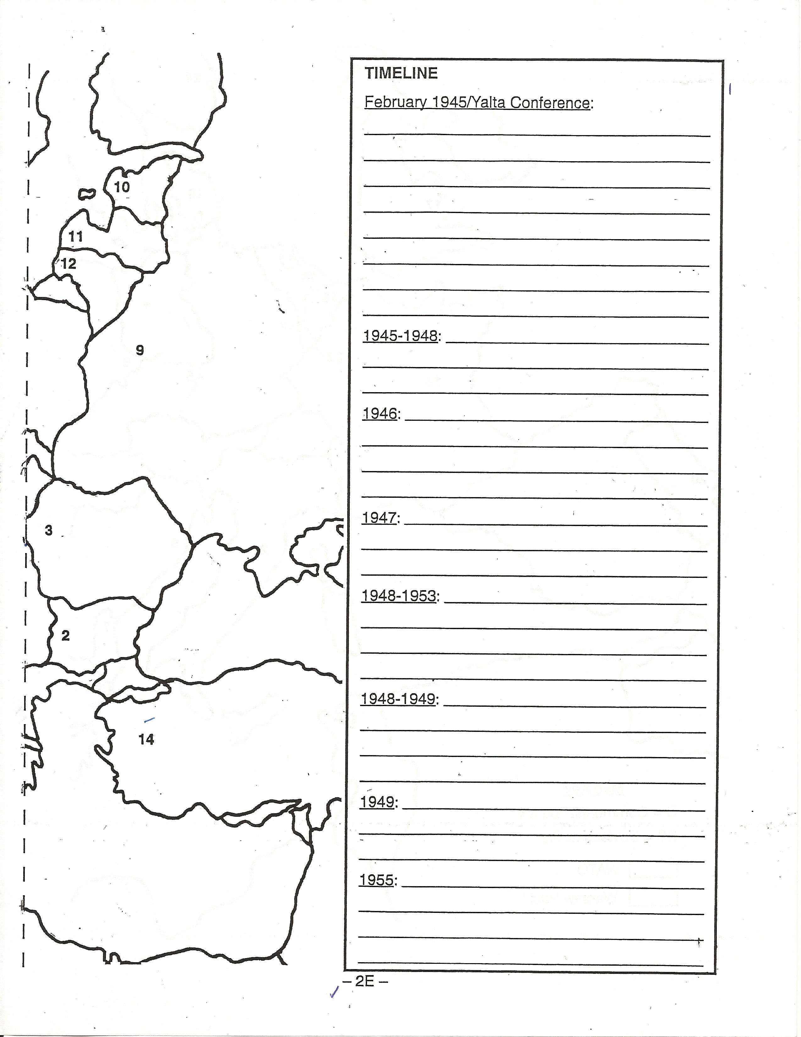
Grab two sheets of loose paper. You’re going to trace and construct the map below using the handouts and/or scans below:
One one piece of paper trace this section (be sure to include the numbers, the dot, and the key):
On the second piece of paper trace this section (including the timeline box with years):
Match up and connect both sections of the map using a glue stick or tape.
Adding to the Map:
Use the directions below to get started on your map. Be sure to reach each section fully and completely. If you skip anything, your map will look weird. When in doubt, do exactly what the directions tell you do.
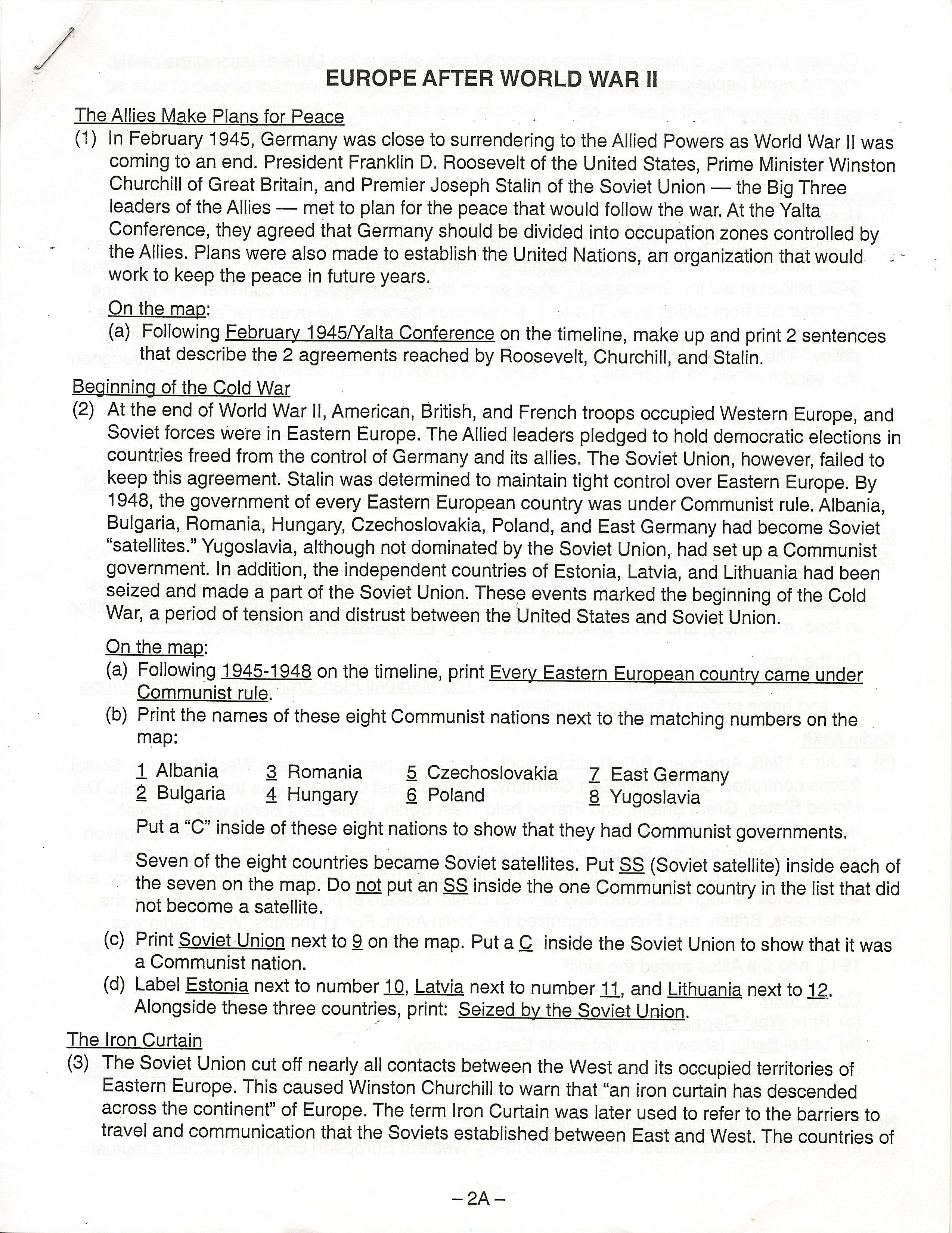
We’ll get the rest tomorrow!
What To Do Tonight:
Finish constructing your map. 🙂
Finish working through the first page of instructions. 🙂
Need some extra credit? Open to a new page in your Interactive Notebook. Title the top line: Crash Course Cold War. Watch the video below and record 10 facts that focus on why tensions got higher between the U.S. and the Soviet Union.
